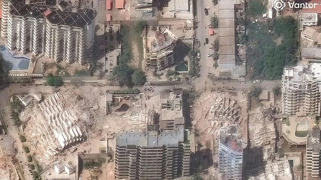
Satellite images reveal the catastrophic scale of destruction in Venezuela following a rare seismic event. On June 24th, the nation was struck by two earthquakes measuring over magnitude 7 on the Richter scale, occurring just 39 seconds apart. This phenomenon, known as a seismic doublet, dramatically multiplies the destructive force.
The confirmed death toll is approaching one thousand, with more than 50,000 people reported missing. The imagery shows entire city blocks reduced to rubble, with high-rise apartment buildings, homes, and public structures collapsed.
One of the hardest-hit areas is La Guaira. International aid is arriving, but the search for survivors is a critical race against time amid widespread looting. Desperate citizens are using social media platforms to post locations of trapped individuals, pleading for rescue teams.
The photographs depict streets once lined with buildings now buried under mountains of brick, stone, and concrete, underscoring the immense humanitarian crisis unfolding in the region.